

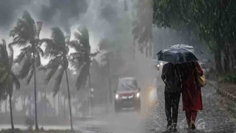

Weather Today, NEW DELHI: Amidst a period of intense summer heat, the India Meteorological Department (IMD) has issued a comprehensive weather alert for 13 states, predicting a mix of thunderstorms, gusty winds, and heavy precipitation. The weather office indicated that several regions, including Uttar Pradesh, Tamil Nadu, Kerala, and Puducherry, are already experiencing consistent rainfall, providing temporary relief from the rising mercury.
According to the latest IMD forecast, a fresh weather system is expected to influence North-West India between May 10 and May 12. This transition is likely to bring moderate to heavy rain accompanied by lightning and high-speed winds ranging from 40 to 60 kilometers per hour. The department has advised residents in the affected zones to take necessary precautions against potential disruptions.
The forecast highlights that states such as Uttar Pradesh, Bihar, Punjab, Haryana, Rajasthan, and parts of Himachal Pradesh are on the radar for upcoming rainfall. Meanwhile, the southern peninsula, specifically Kerala, Tamil Nadu, Puducherry, and Karaikal, will continue to face heavy showers and thundery conditions for the next six to seven days, driven by active atmospheric instabilities.
Severe weather warnings have also been extended to the Northeastern and Eastern belts. The IMD has placed Arunachal Pradesh, Assam, Meghalaya, Sub-Himalayan West Bengal, and Sikkim on alert for heavy rainfall. Additionally, Bihar, Vidarbha, and Telangana are likely to witness hailstorms. On May 9, West Bengal is expected to experience localized storms with wind speeds reaching up to 70 kmph.
In the National Capital Region (NCR), the weather remains in a state of flux. While Delhi saw a pleasant spell between May 3 and May 5 due to hailstorms and rain, temperatures are now on a steady climb. The maximum temperature in Delhi-NCR is expected to touch 40°C by Friday. However, Skymet reports that a new Western Disturbance may activate by May 10, though its impact on the capital remains under observation. Notably, no heatwave (Loo) is expected in Delhi until May 15.


Uttar Pradesh is currently witnessing a “U-turn” in its weather trajectory. Districts like Kanpur have reported stormy conditions since the early hours of Thursday. The IMD has warned of lightning and wind speeds of 50 to 70 kmph across Lucknow, Kanpur, Varanasi, and Meerut, which may offer a brief respite from the heat.
In Bihar, heavy rain and lightning warnings are in place for Patna, Gaya, and Muzaffarpur through May 10. Conversely, Rajasthan presents a divided weather picture; while the eastern districts expect light rain and winds, the western regions, including Jaisalmer and Bikaner, are bracing for an intense heatwave and “Loo” conditions between May 9 and May 11.
Weather conditions in hilly areas
According to the Meteorological Department, Uttarakhand may experience a change in weather on May 7th and 8th. According to the Meteorological Department’s forecast, light to moderate rain is expected in the mountainous regions of the state during these two days. While rain and cool winds will bring pleasant weather to districts like Dehradun, Nainital, Pithoragarh, and Chamoli, temperatures in the plains may rise slightly, resulting in a mild summer.
On the other hand, Himachal Pradesh is also likely to experience the effects of a Western Disturbance. According to the Meteorological Department, the weather will remain variable in various parts of the state between May 7th and 12th, with the main impact expected on May 11th and 12th. During this period, areas like Shimla, Manali, Dharamshala, and Solan are likely to experience cloudy skies, rain, and strong winds. Tourists and local residents will experience a drop in temperatures due to the cool winds.